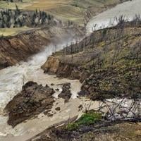
WILLIAMS LAKE, B.C. – First Nations in British Columbia’s central Interior are measuring the impacts of a massive landslide that blocked the Chilcotin River for days, followed by a subsequent torrent of water that sent trees and debris downstream.
The Williams Lake First Nation says village sites that date back 4,000 years were swept away as the Chilcotin River carved away riverbanks, while the Tsilhqot’in National Government says critical salmon migration routes are seriously damaged and the threat of more slides exists.
The landslide south of Williams Lake that dammed the Chilcotin River last week broke free on Monday, sending raging water, trees and debris downstream to the Fraser River, which flows through the Lower Mainland to Georgia Strait.
Two heritage sites located along the banks of the Chilcotin River near the Farwell Canyon Bridge and a third site downstream at the confluence of the Chilcotin and Fraser rivers sustained extensive damage, the Williams Lake First Nation said in a statement Thursday.
“We are grateful that the landslide release has not caused catastrophic damage, but we are deeply saddened by the potential loss of irreplaceable Secwepemc history,” said the statement.
The statement was released following an aerial tour of the landslide and flood area by Williams Lake Chief Willie Sellars.
“We remain hopeful that once the situation stabilizes, valuable Secwepemc artifacts, stories, and insights will still be uncovered,” it said.
B.C.’s Emergency Management Ministry, which has scheduled a news conference Thursday to update the situation, says in a social media post that the flows on the Chilcotin River have now returned to pre-landslide levels and crews are monitoring the area for risk of additional landslides and bank erosion.
Chief Joe Alphonse, the Tsilhqot’in National Government tribal chair, said damage assessments are still underway, but there are now serious concerns about the impact the churning water had on spawning channels for migrating salmon.
With the valuable sockeye salmon run expected to reach the Chilcotin River in the coming days, it appears the landslide and rushing water created difficult new obstacles for the fish on their way to spawning areas, he said in an interview Thursday.
“For salmon passage, it’s going to be a little worrisome,” said Alphonse.
At the landslide site, Alphonse said there’s a pinch point where migrating salmon will have to get through to continue their journey, he said.
“It’s not completely blocked,” Alphonse said. “It’s probably a four- or five-foot jump they’ll have to get through. The amount of pressure shooting through there and the elevation is pretty steep.”
Earlier this week, the Tsilhqot’in launched an emergency salmon task force to call on all levels of government, including U.S. states, to take measures to preserve the sockeye and chinook stocks.
Alphonse called on the Fisheries Department earlier this week to introduce “automatic” sport and commercial fishing restrictions to protect Chilcotin River and Chilko Lake salmon.
The Fisheries Department said in a statement Tuesday that based on historical timing, it believes the majority of adult chinook salmon returning to the Chilcotin River this season migrated past the slide site before last week’s landslide.
It also said the majority of adult sockeye salmon are expected to arrive at the confluence of the Chilcotin and Fraser rivers around the third week in August, and coho not until the early fall.
The Fisheries Department was not immediately available Thursday for comment on the salmon runs.
Alphonse said it also appears much of the Chilcotin’s riverbank area at the Farwell Canyon remains unstable and heavy rains could trigger another landslide.
Downstream communities along the Fraser River at Lillooet, Lytton and Boston Bar reported higher water levels similar to those of spring runoff after the water released, along with the presence of logs and debris.
There have been no reports of flooding.
This report by The Canadian Press was first published Aug. 8, 2024.
