Canadians are unknowingly buying homes in climate change danger zones, report finds - CBC.ca | Canada News Media
Connect with us

News

Canadians are unknowingly buying homes in climate change danger zones, report finds – CBC.ca

Published

 on


Canadians are unknowingly buying and building homes and other infrastructure in areas at high risk of flooding, wildfires and other climate change impacts. That could lead to billions of dollars in damage each year, says a new report from the Canadian Institute for Climate Choices.

Investing in adaptation could slash those costs — but just about no one has the information they need to be able to adapt, according to the report released last week from the federally funded think-tank

“There’s pretty poor understanding of climate risks and really poor risk-disclosure practices across the country,” said Dylan Clark, a senior research associate at the institute and co-author of the report, during a media briefing.

There’s little to no public information on current flood, wildfire or permafrost thaw risks, he said, let alone taking into account the future of climate. 

  • Have questions about climate science, policy or politics? Email us: ask@cbc.ca Your input helps inform our coverage.

“Information that’s readily available to most decision-makers and investors and consumers does not provide enough information to make informed decisions — and that’s a key barrier here to adaptation.”

For example, publicly available government data from local conservation authorities generally show only areas at risk of flooding due to rivers and coasts, the report said.

Researchers were able to obtain data — available for a fee from a private company, JBA Risk Management — that showed 325,000 buildings in Canada are at risk of flooding from heavy rainfall and another 625,000 are at risk from flooding due to rivers breaching their banks, whose owners “have no way of knowing that their properties are at risk of flooding” the report said.

Even JBA’s maps don’t have enough detail to identify individual homes at risk. However, the maps do “highlight that there is that [information] gap,” said Ryan Ness, the report’s lead author.

This image from the new report of the National Capital Region show the risk of a flood so big that it happens once in 100 years, according to publicly available data from local conservation authorities (red) which only looks at river flooding, and data that can be purchased from JBA Risk Management (yellow) which includes storm sewer flooding. (Canadian Institute for Climate Choices/JBA Risk Managenent/)

The report recommends that governments and regulators require owners of existing and proposed buildings and other infrastructure to disclose climate change risks, saying the government should start to generate that information and make it publicly available for that purpose. 

Some federal funding has been allocated in recent years for flood mapping, but the insurance industry has complained that progress has been too slow. Meanwhile, other researchers have found the provinces haven’t been moving fast enough either on flood mapping, emergency plans and critical infrastructure protections to adapt to climate change.

How the research was conducted and what it found

The new report combined two main factors:

  • Information about Canada’s current buildings, roads, railways and electricity infrastructure.
  • Climate models to estimate future costs of damage from climate change. 

Those climate models included:

  • A “lower emissions” scenario, where the world slashes greenhouse gas emissions enough to limit global warming to a peak between 2 and 3 C compared to pre-industrial times, but 3.3 C by 2050 and 4 C by 2100 in Canada, which is warming faster.
  • A “high emissions” scenario, where emissions continue on their current trajectory; in Canada, that’s 4.4 C by 2050 and 7.4 C by 2100.
Hurricane Ida destroys electricity infrastructure at Port Fouchon, La., Thursday, Sept. 2, 2021. In Canada, damage to electrical transmission and distribution infrastructure due to climate change impacts could triple to $4.1 billion a year by 2100, the new report found. (Scott Clause /The Daily Advertiser/The Associated Press)

The study found that under the high emissions scenario, by 2100:

  • Damage to buildings from flooding could increase five-fold by 2050 and 10-fold by 2100 to $13.6 billion each year.
  • Damage to roads and railways due to temperature and rainfall damage could increase to $12.8 billion each year.
  • Damage to electrical transmission and distribution infrastructure could triple to $4.1 billion a year.

However, costs could be cut by reducing global warming through emissions cuts and adaptation to reduce damage from climate change impacts.

“Ultimately, we’ll need both adaptation and mitigation,” said Dale Beugin, the institute’s vice-president of analysis and research and a co-author of the report.

Buyouts in flood zones and other adaptation tactics

The report includes recommendations for steps to adapt Canada’s buildings and other infrastructure to changing climate, which would reduce the damage to people’s lives and property. They include:

  • Buying out 10 per cent of houses in the highest one per cent of flood-risk areas across the country — about 7,500 properties — at a total cost of $1.9 billion, with the potential to save $200 million each year.
  • To reduce coastal flooding, building sea walls, elevating buildings at risk and shoring up eroding beaches.
  • Altering the materials used in asphalt to withstand higher temperatures and increase the depth of the base layer to withstand heavier rainfall.
  • Installing temperature sensors on railway tracks and adjusting train speeds based on temperatures.
  • Replacing electrical transmission and distribution components with more resilient versions.

The researchers acknowledged that much of that adaptation can’t happen without knowing what areas are at risk of damage. 

“The current lack of climate risk information, however, does not justify continued inaction on adaptation,” the report says, adding that recent climate-related impacts and disasters provide enough evidence to start moving on the biggest risks and most vulnerable areas.

The Thomas Creek Fire, 1.5 km east of Skaha Lake, is shown near Okanagan Falls, B.C. in this photo from July 2021. While Canadian flood risk maps are spotty and out-of-date, risk maps for hazards such as wildfires largely don’t exist at all, researchers say. (Penticton Herald-Mark Brett/The Canadian Press)

Nor does it mean the government can’t require disclosure of risks where that information is available, Ness said, so people like homebuilders, homebuyers and insurers can protect themselves.

While there isn’t the full scale of information needed for full disclosure of risks, he said, “there is information that’s out there that’s not being disclosed.”

Regulations requiring disclosure could actually speed up the availability of such data, said Beugin. “This also creates incentives to … generate that information and get more information out there.”

But will the governments act?

Researchers who study climate adaptation said the report was well done, thorough and timely.

Ann Dale, a professor and the director of the School of Environment and Sustainability at Royal Roads University in Victoria, has previously done research on sustainable infrastructure. She said the report was “exactly what’s needed” to show what will happen if governments don’t act on adaptation.

She suggested it could even have gone a bit further and specifically recommended solutions that don’t just adapt, but actually help mitigate climate change, as many nature-based solutions do.

WATCH | Meet the researchers racing to save the Acadian Peninsula from climate change:

Meet the researchers working to save the Acadian Peninsula from climate change

5 months ago

Extreme weather events caused by climate change are eating away at the coastline of New Brunswick’s Acadian Peninsula. A small team of researchers is trying to hold back the waves. 5:40

Ian Burton, professor emeritus at the University of Toronto’s department of geography and planning, who was founding director of the adaptation branch at Environment Canada, said the report’s recommendations are good and he’s hopeful all three levels of government will act on them.

He noted that the federal government funded the report, saying “I hope that will motivate them a little bit to pay attention.”

But the uncertainty about which climate impacts will hit where and when, he said, makes this a challenging problem to tackle.

Even when such reports are commissioned and read by government policy experts, Dale said the pressure to build and repair infrastructure quickly may not allow for new ways of doing things. What’s needed now is political will, she said. 

“We know what to do. We have enough new technology … we need political decision-making to move forward.”

Adblock test (Why?)


Source link

Continue Reading

News

STD epidemic slows as new syphilis and gonorrhea cases fall in US

Published

 on


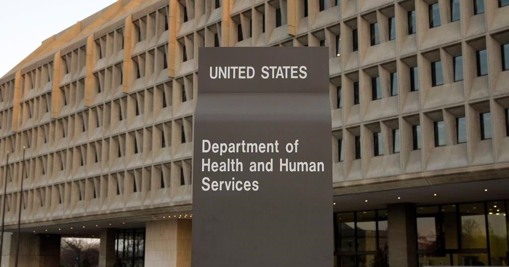
NEW YORK (AP) — The U.S. syphilis epidemic slowed dramatically last year, gonorrhea cases fell and chlamydia cases remained below prepandemic levels, according to federal data released Tuesday.

The numbers represented some good news about sexually transmitted diseases, which experienced some alarming increases in past years due to declining condom use, inadequate sex education, and reduced testing and treatment when the COVID-19 pandemic hit.

Last year, cases of the most infectious stages of syphilis fell 10% from the year before — the first substantial decline in more than two decades. Gonorrhea cases dropped 7%, marking a second straight year of decline and bringing the number below what it was in 2019.

“I’m encouraged, and it’s been a long time since I felt that way” about the nation’s epidemic of sexually transmitted infections, said the CDC’s Dr. Jonathan Mermin. “Something is working.”

More than 2.4 million cases of syphilis, gonorrhea and chlamydia were diagnosed and reported last year — 1.6 million cases of chlamydia, 600,000 of gonorrhea, and more than 209,000 of syphilis.

Syphilis is a particular concern. For centuries, it was a common but feared infection that could deform the body and end in death. New cases plummeted in the U.S. starting in the 1940s when infection-fighting antibiotics became widely available, and they trended down for a half century after that. By 2002, however, cases began rising again, with men who have sex with other men being disproportionately affected.

The new report found cases of syphilis in their early, most infectious stages dropped 13% among gay and bisexual men. It was the first such drop since the agency began reporting data for that group in the mid-2000s.

However, there was a 12% increase in the rate of cases of unknown- or later-stage syphilis — a reflection of people infected years ago.

Cases of syphilis in newborns, passed on from infected mothers, also rose. There were nearly 4,000 cases, including 279 stillbirths and infant deaths.

“This means pregnant women are not being tested often enough,” said Dr. Jeffrey Klausner, a professor of medicine at the University of Southern California.

What caused some of the STD trends to improve? Several experts say one contributor is the growing use of an antibiotic as a “morning-after pill.” Studies have shown that taking doxycycline within 72 hours of unprotected sex cuts the risk of developing syphilis, gonorrhea and chlamydia.

In June, the CDC started recommending doxycycline as a morning-after pill, specifically for gay and bisexual men and transgender women who recently had an STD diagnosis. But health departments and organizations in some cities had been giving the pills to people for a couple years.

Some experts believe that the 2022 mpox outbreak — which mainly hit gay and bisexual men — may have had a lingering effect on sexual behavior in 2023, or at least on people’s willingness to get tested when strange sores appeared.

Another factor may have been an increase in the number of health workers testing people for infections, doing contact tracing and connecting people to treatment. Congress gave $1.2 billion to expand the workforce over five years, including $600 million to states, cities and territories that get STD prevention funding from CDC.

Last year had the “most activity with that funding throughout the U.S.,” said David Harvey, executive director of the National Coalition of STD Directors.

However, Congress ended the funds early as a part of last year’s debt ceiling deal, cutting off $400 million. Some people already have lost their jobs, said a spokeswoman for Harvey’s organization.

Still, Harvey said he had reasons for optimism, including the growing use of doxycycline and a push for at-home STD test kits.

Also, there are reasons to think the next presidential administration could get behind STD prevention. In 2019, then-President Donald Trump announced a campaign to “eliminate” the U.S. HIV epidemic by 2030. (Federal health officials later clarified that the actual goal was a huge reduction in new infections — fewer than 3,000 a year.)

There were nearly 32,000 new HIV infections in 2022, the CDC estimates. But a boost in public health funding for HIV could also also help bring down other sexually transmitted infections, experts said.

“When the government puts in resources, puts in money, we see declines in STDs,” Klausner said.

___

The Associated Press Health and Science Department receives support from the Howard Hughes Medical Institute’s Science and Educational Media Group. The AP is solely responsible for all content.
Source link

Continue Reading

News

World’s largest active volcano Mauna Loa showed telltale warning signs before erupting in 2022

Published

 on


WASHINGTON (AP) — Scientists can’t know precisely when a volcano is about to erupt, but they can sometimes pick up telltale signs.

That happened two years ago with the world’s largest active volcano. About two months before Mauna Loa spewed rivers of glowing orange molten lava, geologists detected small earthquakes nearby and other signs, and they warned residents on Hawaii‘s Big Island.

Now a study of the volcano’s lava confirms their timeline for when the molten rock below was on the move.

“Volcanoes are tricky because we don’t get to watch directly what’s happening inside – we have to look for other signs,” said Erik Klemetti Gonzalez, a volcano expert at Denison University, who was not involved in the study.

Upswelling ground and increased earthquake activity near the volcano resulted from magma rising from lower levels of Earth’s crust to fill chambers beneath the volcano, said Kendra Lynn, a research geologist at the Hawaiian Volcano Observatory and co-author of a new study in Nature Communications.

When pressure was high enough, the magma broke through brittle surface rock and became lava – and the eruption began in late November 2022. Later, researchers collected samples of volcanic rock for analysis.

The chemical makeup of certain crystals within the lava indicated that around 70 days before the eruption, large quantities of molten rock had moved from around 1.9 miles (3 kilometers) to 3 miles (5 kilometers) under the summit to a mile (2 kilometers) or less beneath, the study found. This matched the timeline the geologists had observed with other signs.

The last time Mauna Loa erupted was in 1984. Most of the U.S. volcanoes that scientists consider to be active are found in Hawaii, Alaska and the West Coast.

Worldwide, around 585 volcanoes are considered active.

Scientists can’t predict eruptions, but they can make a “forecast,” said Ben Andrews, who heads the global volcano program at the Smithsonian Institution and who was not involved in the study.

Andrews compared volcano forecasts to weather forecasts – informed “probabilities” that an event will occur. And better data about the past behavior of specific volcanos can help researchers finetune forecasts of future activity, experts say.

(asterisk)We can look for similar patterns in the future and expect that there’s a higher probability of conditions for an eruption happening,” said Klemetti Gonzalez.

___

The Associated Press Health and Science Department receives support from the Howard Hughes Medical Institute’s Science and Educational Media Group. The AP is solely responsible for all content.

The Canadian Press. All rights reserved.

Source link

Continue Reading

News

Waymo’s robotaxis now open to anyone who wants a driverless ride in Los Angeles

Published

 on


Waymo on Tuesday opened its robotaxi service to anyone who wants a ride around Los Angeles, marking another milestone in the evolution of self-driving car technology since the company began as a secret project at Google 15 years ago.

The expansion comes eight months after Waymo began offering rides in Los Angeles to a limited group of passengers chosen from a waiting list that had ballooned to more than 300,000 people. Now, anyone with the Waymo One smartphone app will be able to request a ride around an 80-square-mile (129-square-kilometer) territory spanning the second largest U.S. city.

After Waymo received approval from California regulators to charge for rides 15 months ago, the company initially chose to launch its operations in San Francisco before offering a limited service in Los Angeles.

Before deciding to compete against conventional ride-hailing pioneers Uber and Lyft in California, Waymo unleashed its robotaxis in Phoenix in 2020 and has been steadily extending the reach of its service in that Arizona city ever since.

Driverless rides are proving to be more than just a novelty. Waymo says it now transports more than 50,000 weekly passengers in its robotaxis, a volume of business numbers that helped the company recently raise $5.6 billion from its corporate parent Alphabet and a list of other investors that included venture capital firm Andreesen Horowitz and financial management firm T. Rowe Price.

“Our service has matured quickly and our riders are embracing the many benefits of fully autonomous driving,” Waymo co-CEO Tekedra Mawakana said in a blog post.

Despite its inroads, Waymo is still believed to be losing money. Although Alphabet doesn’t disclose Waymo’s financial results, the robotaxi is a major part of an “Other Bets” division that had suffered an operating loss of $3.3 billion through the first nine months of this year, down from a setback of $4.2 billion at the same time last year.

But Waymo has come a long way since Google began working on self-driving cars in 2009 as part of project “Chauffeur.” Since its 2016 spinoff from Google, Waymo has established itself as the clear leader in a robotaxi industry that’s getting more congested.

Electric auto pioneer Tesla is aiming to launch a rival “Cybercab” service by 2026, although its CEO Elon Musk said he hopes the company can get the required regulatory clearances to operate in Texas and California by next year.

Tesla’s projected timeline for competing against Waymo has been met with skepticism because Musk has made unfulfilled promises about the company’s self-driving car technology for nearly a decade.

Meanwhile, Waymo’s robotaxis have driven more than 20 million fully autonomous miles and provided more than 2 million rides to passengers without encountering a serious accident that resulted in its operations being sidelined.

That safety record is a stark contrast to one of its early rivals, Cruise, a robotaxi service owned by General Motors. Cruise’s California license was suspended last year after one of its driverless cars in San Francisco dragged a jaywalking pedestrian who had been struck by a different car driven by a human.

Cruise is now trying to rebound by joining forces with Uber to make some of its services available next year in U.S. cities that still haven’t been announced. But Waymo also has forged a similar alliance with Uber to dispatch its robotaxi in Atlanta and Austin, Texas next year.

Another robotaxi service, Amazon’s Zoox, is hoping to begin offering driverless rides to the general public in Las Vegas at some point next year before also launching in San Francisco.

The Canadian Press. All rights reserved.

Source link

Continue Reading

Trending

Exit mobile version