Former B.C. Liberal minister says he may vote NDP, as Eby woos disaffected centrists | Canada News Media
Connect with us

News

Former B.C. Liberal minister says he may vote NDP, as Eby woos disaffected centrists

Published

 on


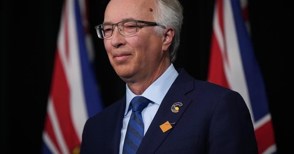
VICTORIA – Former British Columbia Liberal cabinet minister Terry Lake says he’ll consider voting for Premier David Eby’s New Democrats if the B.C. Conservatives don’t shift to the political centre, especially on the issue of climate change.

Lake, an environment and health minister in former premier Christy Clark’s Liberal government, says in an interview he may have no other choice in his Kamloops riding if B.C. Conservative Leader John Rustad maintains his party’s stances on environmental and social issues.

His remarks come as the NDP courts disaffected supporters of BC United, formerly known as the B.C. Liberals, after Leader Kevin Falcon scrapped the Official Opposition’s election campaign and urged voters to support the Conservatives to prevent vote-splitting and the NDP’s re-election in the fall.

An NDP news release quotes Lake and BC United figures, linking their comments about the political upheaval to Eby’s offer to provide a home in the NDP for centrists.

Lake, who also ran for the federal Liberals in Kamloops in 2019, is among several political figures expressing concern this week at the folding of BC United’s campaign

West Vancouver-Capilano BC United MLA Karin Kirkpatrick says Falcon’s move did not consider that middle-of-the-road voters “would be forced to swing to the left.”

Rustad, who was ejected by Falcon from the former B.C. Liberal caucus for his skeptical views on climate science, said this week the Conservatives will not be making changes.

Eby had posted on social media on Thursday that his phone was “blowing up” with calls from former B.C. Liberal voters who could not bring themselves to support Rustad, saying the NDP welcomed such voters with concerns about climate change, reproductive freedom and building up the health care system.

This report by The Canadian Press was first published Aug. 30, 2024.
The Canadian Press. All rights reserved.

Source link

Continue Reading

News

Whistler, Pemberton, Sea-to-Sky Highway in B.C.to see ‘significant snowfall’

Published

 on

VANCOUVER – Whistler, B.C., is expected to see its first “significant snowfall” of the season this weekend.

The company that owns Whistler-Blackcomb says it is kicking off the season by opening one of its ski hills a day earlier than expected.

Vail Resorts says Blackcomb Mountain will be open for skiing starting next Thursday, and Whistler Mountain will open the following day.

The report for Whistler-Blackcomb on Friday says the area had seen 43 centimetres of snowfall over 48 hours and 95 centimetres in the last week.

The update came as Environment Canada issued a special weather statement for the Sea to Sky region, including Whistler, Squamish and Pemberton.

It says a weather system was expected to arrive on Saturday, bringing rain to the coast and snow to inland areas, where a mix of snow and rain was also possible.

The bulletin says parts of the Sea to Sky region could see 10 to 15 centimetres of snow before it tapers off Saturday night.

In Metro Vancouver, the weather office says Saturday will bring strong winds and heavy rain that may lead to power outages.

A special weather statement for the region says total rainfall could range from 30 to 50 millimetres before easing overnight on Saturday.

In eastern B.C., Environment Canada issued snowfall warnings Friday for parts of the Cariboo region as well as the Kinbasket, McGregor and North Columbia areas.

The bulletin says a storm system was expected to cross B.C.’s central Interior on Saturday, with the heaviest snowfall in areas near the Alberta boundary and the Cariboo Mountains.

Areas further west, along the Highway 97 corridor, will see lower levels of snow accumulation, the weather office says.

This report by The Canadian Press was first published Nov. 15, 2024.

The Canadian Press. All rights reserved.


Source link

Continue Reading

News

No single factor led to water main failure in Calgary: preliminary report

Published

 on

CALGARY – A preliminary report into the feeder main failure in Calgary that led to two rounds of water restrictions earlier this year has indicated that it wasn’t caused by any one factor.

The Bearspaw South Feeder Main in northwest Calgary burst in early June, forcing a citywide clampdown on water use that included residents being asked to skip toilet flushes and hold off on doing laundry and dishes.

Restrictions had mostly been eased when the city said in August that more trouble spots had been found along the pipe and it would need to be dug up and reinforced, meaning a return of rules like a ban on using potable water outside.

The preliminary report says several factors may have contributed to the feeder main failure, including microcracking of the protective mortar outer layer of the pipe, high chloride levels in soil, and wires that snapped due to corrosion and hydrogen embrittlement.

The city says administration will be updating the public on the preliminary findings at a council meeting on Nov. 26, with the final report to be presented to a committee in December.

It says it’s reviewing options for long-term rehabilitation of the feeder main and continuing with contingency planning.

Michael Thompson, the city’s general manager of infrastructure services, says the pipe is responding well to the rehabilitation work that has been done since June and it is now stabilized.

“Through our acoustic monitoring, we have recorded only two wire snaps on the feeder main between October and November,” Thompson said in a statement. “Throughout July and August, there were 23 wire snaps.”

Officials say the preliminary review also confirmed the original design of the pipe was consistent with the proper guidelines at the time and operations were well within design parameters.

This report by The Canadian Press was first published Nov. 15, 2024.

The Canadian Press. All rights reserved.


Source link

Continue Reading

News

Heavy rain mixed with strong winds hitting B.C. south coast over the weekend

Published

 on

VANCOUVER – Residents in Metro Vancouver will likely be getting out their umbrellas this weekend as the region faces heavy rain and wind.

Environment Canada has issued a special weather statement for Metro Vancouver, including Vancouver, Burnaby and New Westminster, with heavy rainfalls and strong winds expected to last into the evening on Saturday.

The agency says a Pacific frontal system is bringing heavy rain and strong winds to the south coast, with total rainfall amounts of up to 40 millimetres expected before it tapers off to a few showers overnight.

Strong winds gusting up to 70 kilometres per hour will develop over areas near the Strait of Georgia and Boundary Bay.

Whistler, B.C. is expected to see its first “significant snowfall” of the season this weekend as Environment Canada issued a special weather statement for the Sea to Sky region, including Whistler, Squamish and Pemberton.

A special weather statement is also in effect for the Coquihalla Highway, with the weather agency saying about 10 to 15 centimetres of snow is expected on the Coquihalla Highway from Hope to Merritt on Saturday.

This report by The Canadian Press was first published Nov. 16, 2024.

The Canadian Press. All rights reserved.


Source link

Continue Reading

Trending

Exit mobile version