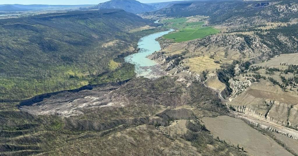
VANCOUVER – Worst-case scenario modelling of the potential impacts of an over-the-top water breach of a massive landslide blocking British Columbia’s Chilcotin River points to reduced flood threats downstream, Emergency Management Minister Bowinn Ma said Saturday.
Downstream Fraser River communities of Lillooet, Lytton, Boston Bar and Hope can expect to see higher water levels if the slide blocking the Chilcotin River south of Williams Lake gives way in the coming days, but the water flows will be similar to those of a normal spring run off season, she said at a news conference.
“Worst case scenario modelling suggests that while flows in the Chilcotin River are expected to be well above normal freshet flows, water levels in the Fraser River are likely to be lower than what we would normally see during a normal freshet season,” said Ma. “Ultimately, this is an encouraging development for communities downstream.”
Nathan Cullen, water, land and resource stewardship minister, said the slide scenario still has the potential to impact the Chilcotin River ecosystem, but the Fraser River appears able to handle what could be on the way.
“The modelling now suggests that even under those worst-case scenarios of a significant breach happening quite quickly, water levels, particularly in the Fraser River, might be slightly higher than what we would expect during a typical spring snowmelt season,” he said.
A landslide Wednesday at Farwell Canyon located about 22 kilometres south of Williams Lake dammed the Chilcotin River and created a lake about 11 kilometres long behind the slide.
The slide was estimated Saturday by B.C.’s Ministry of Water, Land and Resource Stewardship to be 1,000 metres long, 100 metres wide and about 30 metres high.
Connie Chapman, the ministry’s water management executive director, said a worst case scenario model looked at a massive over-the-top water breach of the slide area, sending torrents of water downstream within one hour.
She said the modelling estimates water levels 10 metres higher than currently normal reaching the nearby Farwell Canyon Bridge within 90 minutes, but once the water arrives at Lillooet on the Fraser River about 15 hours later, the levels will be dramatically reduced.
“The good news is once we hit the Fraser River this water and material has a significant amount of room to spread out and disperse,” Chapman said. “As we move downstream and get to the area of Lillooet, the Fraser River will only be about 1.8 metres above what it’s currently at.”
At Hope, about 29 hours later, “we will only see about a 30 centimetre increase,” said Chapman.
A second modelling scenario examined the possibility of a slower slide breach over a period of 24 hours where water moved downstream at a less rapid pace, reaching the Farwell Canyon Bridge within 9.5 hours, she said.
But Both Ma and Cullen said dangers still remain and people should heed evacuation orders and alerts and stay away from the river areas.
Ma said earlier flood preparation equipment and sandbags are being sent to some communities along the Fraser River and planning is underway in case there’s a need to evacuate some communities, although that is unlikely.
The province issued an emergency alert late Friday, warning people anywhere on the Chilcotin River or along its banks between the Hanceville Bridge and the Fraser River to evacuate immediately.
The situation is also being monitored by the federal Fisheries Department, which says adult chinook and sockeye salmon are currently present in the river, and likely to be affected by the blockage.
Cullen said many of the Chinook have already reached spawning grounds above the slide area and sockeye in the Fraser River are not expected to reach the slide zone for another four to seven days.
This report by The Canadian Press was first published Aug. 3, 2024.
