adplus-dvertising
Connect with us

News

Long-promised flood-prevention project in Manitoba under review with no timeline

Published

 on


WINNIPEG – A long-promised $600-million flood prevention project in Manitoba is now under review, and the provincial government has opened the door to redesigning it with no timeline for starting construction.

The NDP government said it has asked Ottawa to pause a decision on the plan, in order to fully consult First Nations and consider possible alternatives to the design. It would currently have two large outlet channels built to drain water from Lake Manitoba into Lake St. Martin then into Lake Winnipeg.

“The federal government had already expressed significant concerns,” Lisa Naylor, Manitoba’s minister of transportation and infrastructure, said Thursday.

“If the federal government had withdrawn the licence because of the environmental impact, the project would be dead. And so, I don’t want to see that happen.”

The project has been talked about for more than a decade, following severe flooding in 2011 that forced thousands of people from their homes.

The former Progressive Conservative government promised in 2016 to build the project quickly but butted heads for years with federal regulators, who called for more consultation with First Nations that would be affected.

In 2022, a Court of Queen’s Bench judge ruled the government did not consult properly before setting up a right of way on Crown land for preparatory work, such as groundwater monitoring.

A report in June from the federal Impact Assessment Agency said the project’s environmental effects could be addressed, but it would have significant impact on Indigenous land use. The federal environment minister said he would refer the issue to cabinet for a decision.

Seeking a pause on that process will give the province time to address concerns of First Nations communities and Ottawa, Naylor said.

The Tories, now in Opposition, said there was consultation and the project needs to move ahead to prevent another disastrous flood in the region.

“I think there were hundreds and hundreds of consultations that have been done with First Nations,” interim party leader Wayne Ewasko said. Technical documents, including papers translated into Cree and Ojibway, were posted online and shared with community members, he added.

Naylor said the pause will also let the government consider changing the project’s design.

“A number of smaller mitigation projects have taken place over the years that may change what the outcome ultimately needs to look like,” she said.

The province is signing a memorandum of understanding on next steps with the Interlake Reserves Tribal Council, which represents several communities in the region.

Cornell McLean, chief of Lake Manitoba First Nation, said he’s pleased with the government’s commitment because there has been no meaningful consultation to date.

“There has been none, and they say there were text messages, phone calls, faxes. And I said, ‘Well, that’s not consultation,'” McLean said.

“If you want to have true consultation, it’s face-to-face, meaningful consultation.”

This report by The Canadian Press was first published Oct. 17, 2024.

The Canadian Press. All rights reserved.

Source link

Continue Reading

News

Whistler, Pemberton, Sea-to-Sky Highway in B.C.to see ‘significant snowfall’

Published

 on

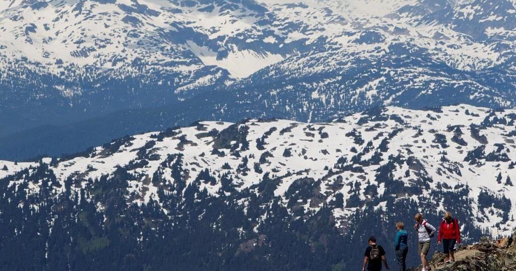
VANCOUVER – Whistler, B.C., is expected to see its first “significant snowfall” of the season this weekend.

The company that owns Whistler-Blackcomb says it is kicking off the season by opening one of its ski hills a day earlier than expected.

Vail Resorts says Blackcomb Mountain will be open for skiing starting next Thursday, and Whistler Mountain will open the following day.

The report for Whistler-Blackcomb on Friday says the area had seen 43 centimetres of snowfall over 48 hours and 95 centimetres in the last week.

The update came as Environment Canada issued a special weather statement for the Sea to Sky region, including Whistler, Squamish and Pemberton.

It says a weather system was expected to arrive on Saturday, bringing rain to the coast and snow to inland areas, where a mix of snow and rain was also possible.

The bulletin says parts of the Sea to Sky region could see 10 to 15 centimetres of snow before it tapers off Saturday night.

In Metro Vancouver, the weather office says Saturday will bring strong winds and heavy rain that may lead to power outages.

A special weather statement for the region says total rainfall could range from 30 to 50 millimetres before easing overnight on Saturday.

In eastern B.C., Environment Canada issued snowfall warnings Friday for parts of the Cariboo region as well as the Kinbasket, McGregor and North Columbia areas.

The bulletin says a storm system was expected to cross B.C.’s central Interior on Saturday, with the heaviest snowfall in areas near the Alberta boundary and the Cariboo Mountains.

Areas further west, along the Highway 97 corridor, will see lower levels of snow accumulation, the weather office says.

This report by The Canadian Press was first published Nov. 15, 2024.

The Canadian Press. All rights reserved.


Source link

Continue Reading

News

No single factor led to water main failure in Calgary: preliminary report

Published

 on

CALGARY – A preliminary report into the feeder main failure in Calgary that led to two rounds of water restrictions earlier this year has indicated that it wasn’t caused by any one factor.

The Bearspaw South Feeder Main in northwest Calgary burst in early June, forcing a citywide clampdown on water use that included residents being asked to skip toilet flushes and hold off on doing laundry and dishes.

Restrictions had mostly been eased when the city said in August that more trouble spots had been found along the pipe and it would need to be dug up and reinforced, meaning a return of rules like a ban on using potable water outside.

The preliminary report says several factors may have contributed to the feeder main failure, including microcracking of the protective mortar outer layer of the pipe, high chloride levels in soil, and wires that snapped due to corrosion and hydrogen embrittlement.

The city says administration will be updating the public on the preliminary findings at a council meeting on Nov. 26, with the final report to be presented to a committee in December.

It says it’s reviewing options for long-term rehabilitation of the feeder main and continuing with contingency planning.

Michael Thompson, the city’s general manager of infrastructure services, says the pipe is responding well to the rehabilitation work that has been done since June and it is now stabilized.

“Through our acoustic monitoring, we have recorded only two wire snaps on the feeder main between October and November,” Thompson said in a statement. “Throughout July and August, there were 23 wire snaps.”

Officials say the preliminary review also confirmed the original design of the pipe was consistent with the proper guidelines at the time and operations were well within design parameters.

This report by The Canadian Press was first published Nov. 15, 2024.

The Canadian Press. All rights reserved.


Source link

Continue Reading

News

Heavy rain mixed with strong winds hitting B.C. south coast over the weekend

Published

 on

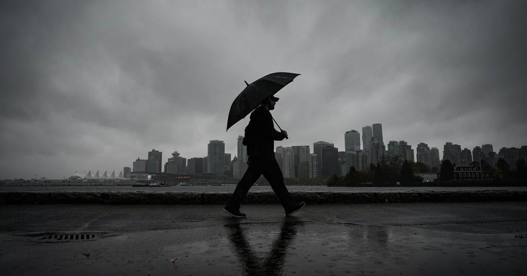
VANCOUVER – Residents in Metro Vancouver will likely be getting out their umbrellas this weekend as the region faces heavy rain and wind.

Environment Canada has issued a special weather statement for Metro Vancouver, including Vancouver, Burnaby and New Westminster, with heavy rainfalls and strong winds expected to last into the evening on Saturday.

The agency says a Pacific frontal system is bringing heavy rain and strong winds to the south coast, with total rainfall amounts of up to 40 millimetres expected before it tapers off to a few showers overnight.

Strong winds gusting up to 70 kilometres per hour will develop over areas near the Strait of Georgia and Boundary Bay.

Whistler, B.C. is expected to see its first “significant snowfall” of the season this weekend as Environment Canada issued a special weather statement for the Sea to Sky region, including Whistler, Squamish and Pemberton.

A special weather statement is also in effect for the Coquihalla Highway, with the weather agency saying about 10 to 15 centimetres of snow is expected on the Coquihalla Highway from Hope to Merritt on Saturday.

This report by The Canadian Press was first published Nov. 16, 2024.

The Canadian Press. All rights reserved.


Source link

Continue Reading

Trending