


Digital WritersThe Weather Network

Updated on Apr. 23, 2024, 1:30 PM
Prepare for multiple rounds of April snowfall this week, as Labrador braces for wintry conditions. This onslaught of snow is expected to blanket the region, potentially leading to hazardous travel conditions and disruptions throughout the week
As we march even deeper into the heart of the spring season, many parts of Canada are finding it tough to find any consistent signs of warming weather. Add to the mix periods of snow and wintry precipitation, and it’s safe to say the winter season is certainly not going out without a strong fight.
This week, parts of the East Coast will bear the brunt of the winter weather, with multiple rounds of April snowfall stacking up in Labrador. The chances for snow flurries will stick around all week long, bringing as much as 25 cm for some.
MUST SEE: Extreme pattern over Arctic produces 50+ degree temperature spread
Although 25+ cm of snow in April may seem extreme, for this part of the country, it’s definitely nothing out of the ordinary. In fact, the month as a whole brings about 40-50 cm of snow to Labrador on average.
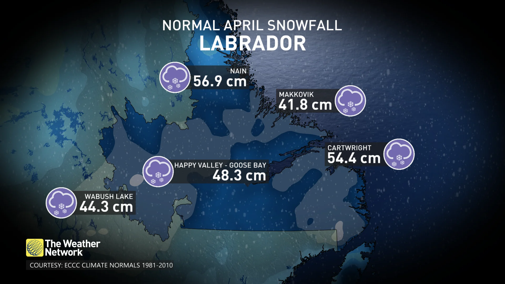
Some communities, including Nain, even have snowfall chances stretch all the way into June!
“This week will be a little bit different however, as some regions could reach about half of Labrador’s monthly averages alone,” says Rachel Modestino, a meteorologist at The Weather Network. “The first round on Tuesday will pack quite the punch, with heavy snow and gusty winds stretching from Labrador city to the coast.”
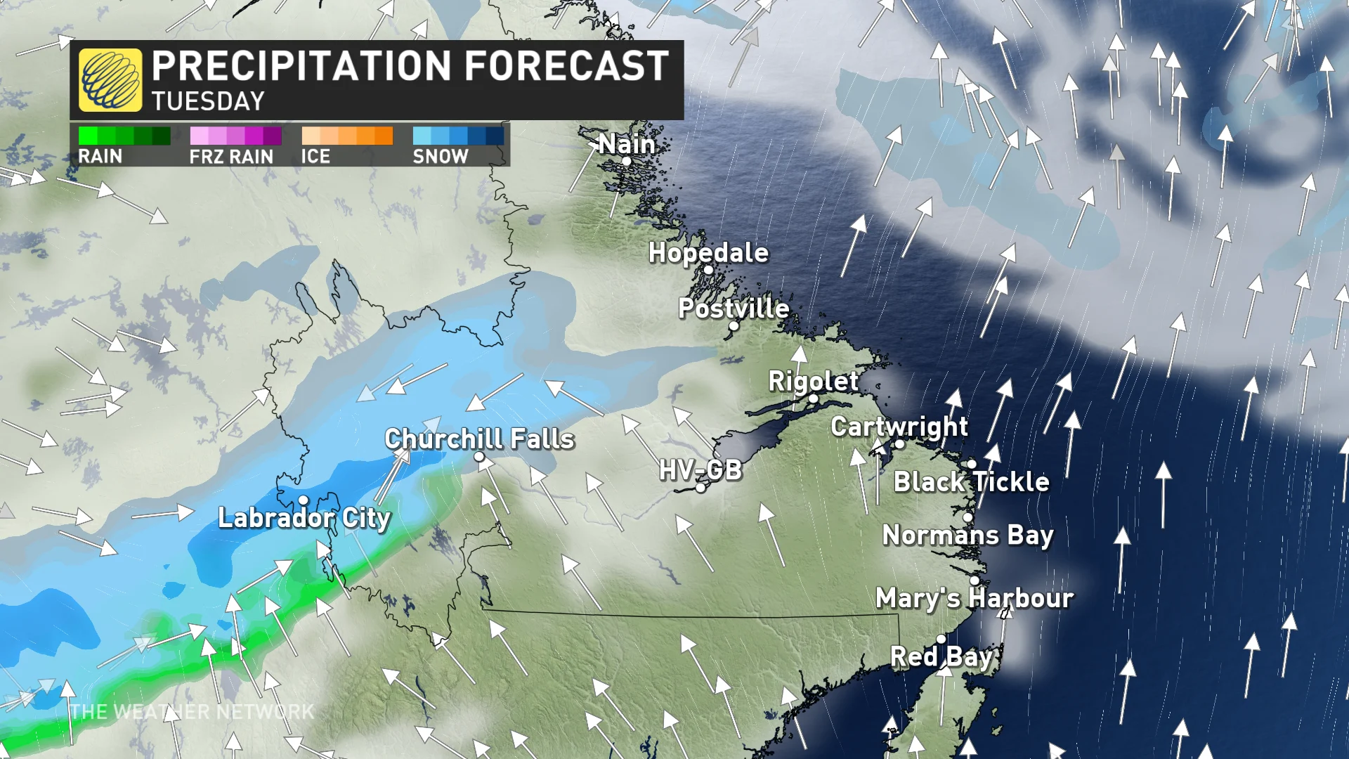
Winds will be gusting between 70-90 km/h at times, and travel conditions will likely deteriorate quickly due to potential whiteouts and reduced visibility.


