



An earthquake south of Newfoundland on Nov. 18, 1929, set off a tsunami that struck the Burin Peninsula about two and a half hours later, killing 27 or 28 people and leaving more than 1,000 homeless, according to Wikipedia’s account of the 1929 Grand Banks earthquake and The Weather Network.
The quake struck at 5:02 p.m. local time on a Monday. All three sources consulted for this article, the Newfoundland and Labrador Heritage Web Site, Wikipedia and The Weather Network, put its magnitude at 7.2. The epicentre lay on the Grand Banks, though the sources differ on the distance: the heritage site says about 265 kilometres south of the peninsula, while The Weather Network says about 400 kilometres south of the Grand Banks.
Residents felt the shaking for several minutes, according to the heritage site, which said it caused no serious damage to houses. The sea was the danger. Wikipedia said the tsunami arrived in three waves, the first about 2 hours and 23 minutes after the quake, and the heritage site put the first trough at about 7:30 p.m. on a calm evening.
The wave heights vary by source. The Weather Network and Wikipedia gave wave amplitudes of three to eight metres, with Wikipedia citing a run-up of 13 metres on the Burin Peninsula. The heritage site said water in long, narrow bays such as Port au Bras and Taylor’s Bay rose 13 to 27 metres.
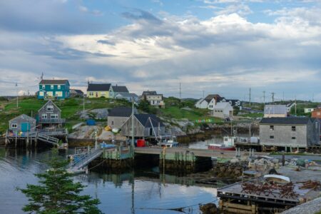
The heritage site said more than 40 communities on the peninsula were hit. In Point au Gaul, close to 100 buildings were destroyed. In St. Lawrence, all the fishing flakes, stages and motorboats were lost. In Taylor’s Bay, five of 17 houses were left standing. The heritage site named six communities where people died: Allan’s Island, Kelly’s Cove, Point au Gaul, Lord’s Cove, Taylor’s Bay and Port au Bras.
The death toll is also not settled. The heritage site counted 28 deaths, 25 by drowning, with six bodies never found and three more people dying later of shock or tsunami-related causes. Wikipedia reported 27 or 28. It said Dr. Harris Munden Mosdell, chairman of the Board of Health for Burin West, wrote in his report on loss of life that the tidal wave’s toll “totals twenty-seven,” and that later research added one more.
Help was slow to arrive. The heritage site said a storm had cut the only telegraph line to the peninsula, and the Squires government learned of the disaster almost three days later. On Nov. 21, the coastal steamer SS Portia stopped at Burin on its regular run, and its wireless operator sent word to St. John’s. Wikipedia said the SS Meigle then carried supplies, doctors, nurses, blankets and food, and that donations from Newfoundland, the United States and the United Kingdom totalled about $250,000.
Estimates of the cost also differ. The heritage site said a government assessment put property damage on the peninsula at $1 million, while Wikipedia gave a total of $400,000.
The disaster also changed the science of the sea floor. According to Wikipedia, the quake triggered a huge submarine landslide that broke 12 transatlantic telegraph cables. In 1952, Columbia University scientists Bruce Heezen and Maurice Ewing pieced together the order in which the cables had snapped, Wikipedia said, and that sequence gave the first documentation of a turbidity current, a fast-moving flow of sediment down the ocean floor.
Tsunamis remain a concern for Canada’s coasts. Our earlier story on the massive Russian quake and the tsunami it sent toward British Columbia covers a recent scare, and a look back at the waves that swamped Port Alberni, B.C., in 1964 recalls an earlier west coast disaster.
If you find reporting like this useful, consider supporting Canada News Media, an independently owned Canadian newsroom.
Follow Canada News Media
Get the day's top Canadian stories and our two daily 60-second news videos wherever you scroll.
X Threads Facebook Instagram LinkedIn TikTok YouTube Pinterest Reddit Substack Flipboard Newsletter RSS